Japanese Government Launched Minecraft Map of Tourist Attraction
|
|
Key points
- Japan’s Ministry of Land, Infrastructure, Transport and Tourism (MLIT) released a Minecraft map replica of an underground flood control facility in Tokyo.
- The map was released for free and promotes G-Cans, the flood control facility, as a tourist attraction.
- A narrated video showcasing the project was released on the official MLIT YouTube Channel.
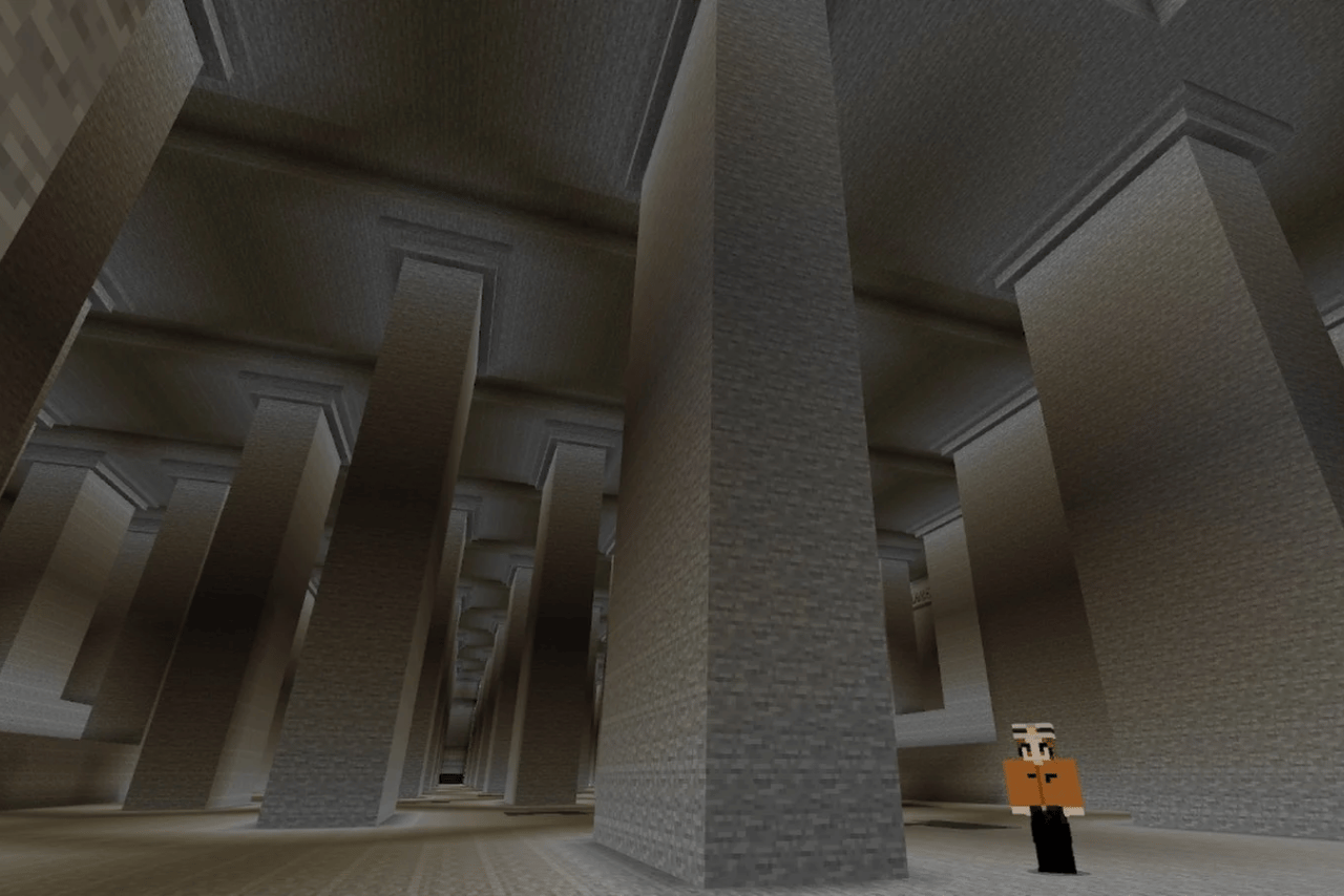
The Japanese government launched a Minecraft replica of an underground flood control facility located in the Greater Tokyo Area. Published by Japan’s Ministry of Land, Infrastructure, Transport, and Tourism (MLIT), the Minecraft map serves to inform the general populace alongside market Metropolitan Area Outer Underground Discharge Channel as tourist attractions; the underground discharge channel is also called G-Cans.
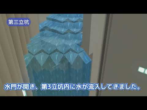
Not only did they make the map free for the public, but they also published an animated and fully narrated YouTube video:
Upon entering the Minecraft map, players are greeted by a worker NPC. Gamers interested in accessing the map can do so by following the instructions on the government website, which are in Japanese. Automaton provides more details of the virtual iteration of the tourist attraction.
G-Cans is the world’s largest underground flood control facility. By controlling river water levels, the facility helps prevent floods and landslides. The tourist attraction’s main appealing spot is the underground chamber. Pillars support the temple-like structure, thereby earning its nickname “Underground Temple of Disaster Prevention.”